
Module talk:Location map/data/Syria
Map
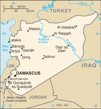
"Syria location map2" follows mainstream map unlike "Syria location map". --Supreme Deliciousness (talk) 22:04, 24 October 2010 (UTC)
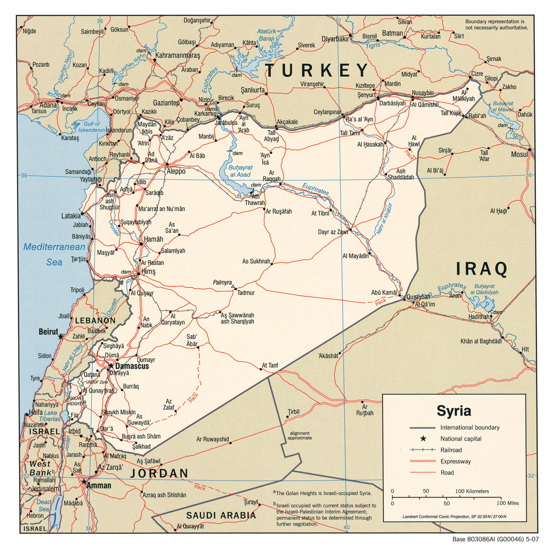
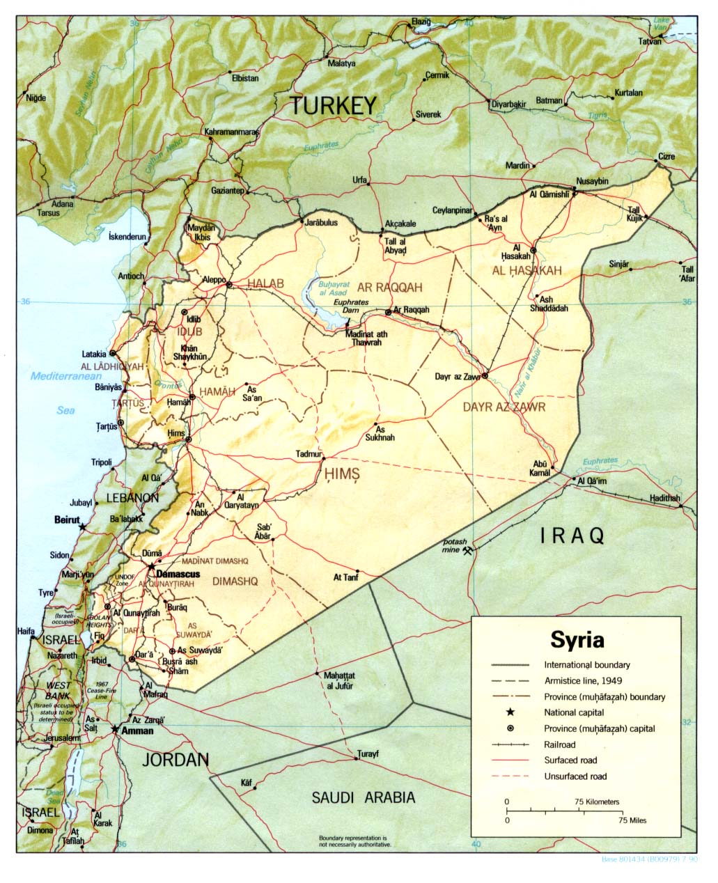
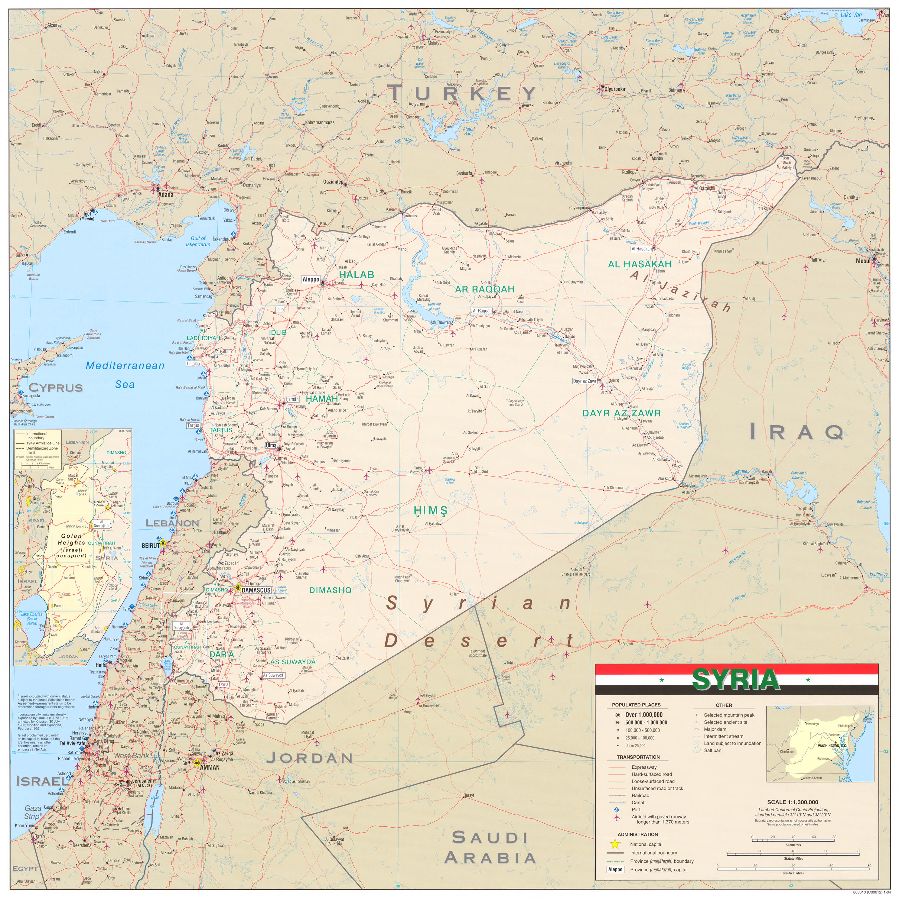
- http://www.lib.utexas.edu/maps/middle_east_and_asia/syria_pol_2007.jpg
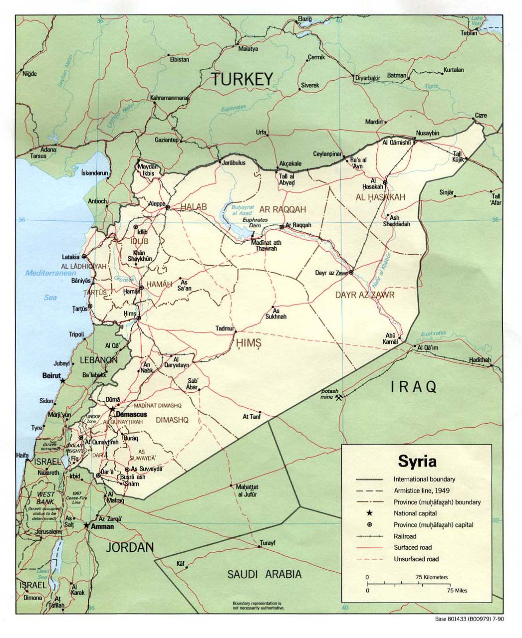
- http://www.lib.utexas.edu/maps/middle_east_and_asia/syria_pol90.jpg
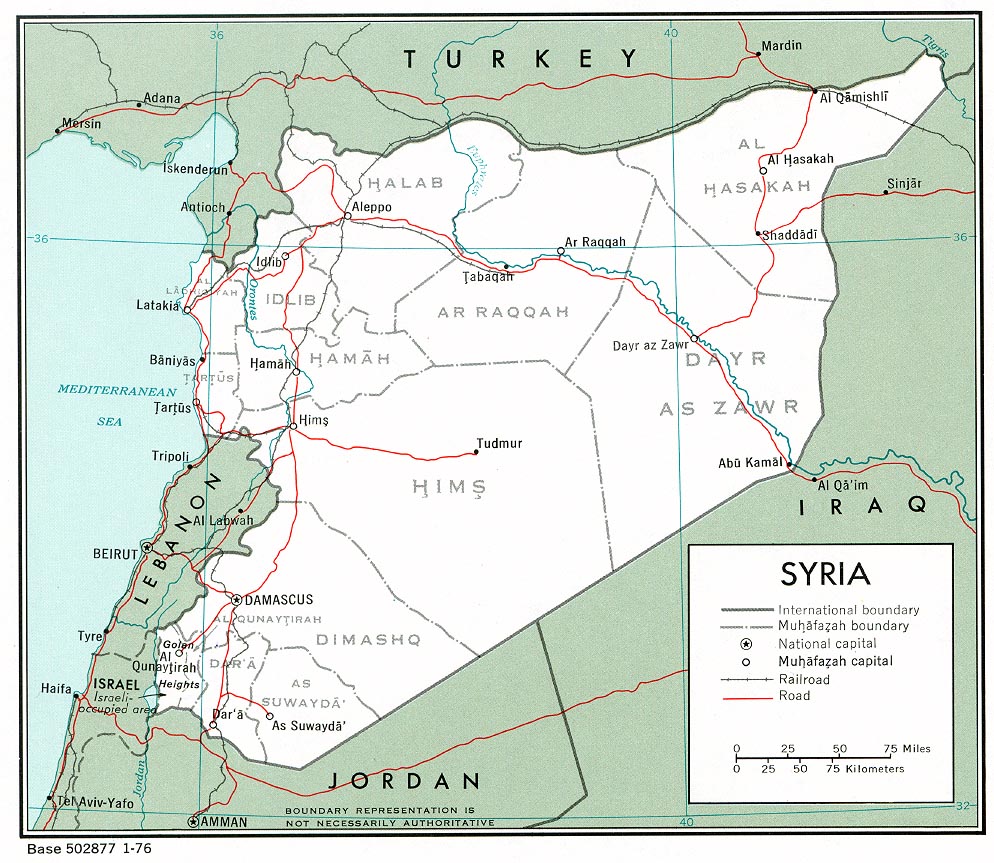
- http://www.lib.utexas.edu/maps/middle_east_and_asia/syria_pol_1976.jpg
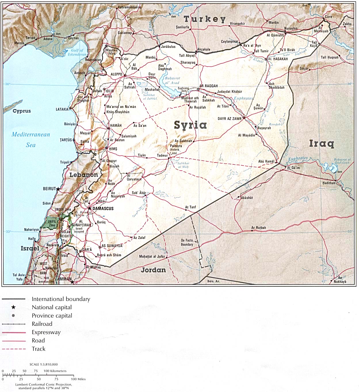
- http://www.lib.utexas.edu/maps/atlas_middle_east/syria_map.jpg
- http://www.lib.utexas.edu/maps/middle_east_and_asia/syria_rel90.jpg
- http://www.lib.utexas.edu/maps/cia10/syria_sm_2010.gif
- http://www.lib.utexas.edu/maps/middle_east_and_asia/syria_wall_2004.jpg
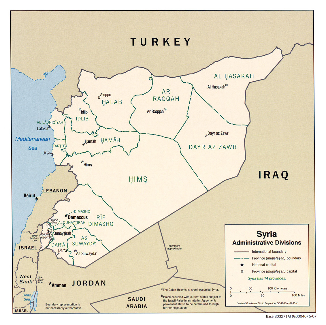
- http://www.lib.utexas.edu/maps/middle_east_and_asia/syria_admin_2007.jpg
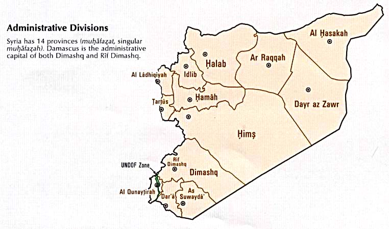
- http://www.lib.utexas.edu/maps/atlas_middle_east/syria_divisions.jpg
- http://www.lib.utexas.edu/maps/atlas_middle_east/syria_econ.jpg
- http://www.un.org/Depts/Cartographic/map/profile/syria.pdf --Supreme Deliciousness (talk) 22:04, 24 October 2010 (UTC)
- "Syria location map2" doesn't exist. --Obersachse (talk) 16:17, 25 October 2010 (UTC)
- yes it does:[1] --Supreme Deliciousness (talk) 16:32, 25 October 2010 (UTC)
- Oh, sorry. I thought you're talking about Template:Syria location map2. --Obersachse (talk) 19:36, 25 October 2010 (UTC)
- yes it does:[1] --Supreme Deliciousness (talk) 16:32, 25 October 2010 (UTC)
![[1]](/wiki/File:Syria_location_map2.svg)
Restoration of location map
The location map2 is bringing a lot of confusion, as the Quneitra area shows fully under Syrian control in light of the civil war; de-facto nearly one half of Quneitra area is under Israeli military control from 1967.Greyshark09 (talk) 07:15, 9 June 2013 (UTC)
- The map2 shows the accurate boundaries of Syria, which the other one does not. --Supreme Deliciousness (talk) 08:19, 9 June 2013 (UTC)
- I would have no problem with that map, as long as Israeli-controlled area is colored differently when the rest of Syria (same as Hatay issue).Greyshark09 (talk) 08:22, 9 June 2013 (UTC)
- All of Syria must be in the same color, and the Map2 is in accordance with UN and CIA maps, your non neutral edit strongly violates npov and is contradicting reality. --Supreme Deliciousness (talk) 08:26, 9 June 2013 (UTC)
- Don't exaggerate, the one violating NPOV is yourself. Syria is now fractured and political claims need to be carefully put, not-denying political claims of Syria on the Israeli-controlled Golan. This is why it has to be a different color. I will bring other users from a related discussion.Greyshark09 (talk) 08:58, 9 June 2013 (UTC)
- All of Syria must be in the same color, and the Map2 is in accordance with UN and CIA maps, your non neutral edit strongly violates npov and is contradicting reality. --Supreme Deliciousness (talk) 08:26, 9 June 2013 (UTC)
- I would have no problem with that map, as long as Israeli-controlled area is colored differently when the rest of Syria (same as Hatay issue).Greyshark09 (talk) 08:22, 9 June 2013 (UTC)
Should Israeli-controlled part of Golan be in different color?


I will start here a poll whether Israeli-controlled part of the Golan (from 1967) should have a different color than Syrian territory (rebel or government controlled combined). There is no need to put "Israeli Golan Heights" within the borders of Israel, but simply color slightly differently than the rest of Syria. Current version of the map, advocated by Supreme is highly confusing, letting think that Israeli-controlled part of the Golan is also part of the Syrian civil war theater (here). Please vote whether we need the same color (for "Syria location map2") or different color (for "Syria location map").Greyshark09 (talk) 08:58, 9 June 2013 (UTC)
- Different color (Syria location map) - for the above stated reasons.Greyshark09 (talk) 08:58, 9 June 2013 (UTC)
- The Israeli-occupied part of the Golan is Syrian territory. There is no such thing as "Israeli Golan Heights" as you call it. The map2 shows the dmz line separating the Israeli-occupied part of Syria from the rest of Syria, making the color different would imply that the part occupied by Israel is not Syria. And as can be seen above: UN and CIA maps have the same color for all of Syria. If you have any problems with maps in regards to who controls what in the Syrian civil war then custom maps can be created. And the Israeli-occupied part of Syria is part of the Syrian Uprising as Syrians living under the foreign Israeli occupation have demonstrated in their villages there, mortars have landed there and peoples have also fled there. --Supreme Deliciousness (talk) 09:39, 9 June 2013 (UTC)
- I said "Israeli-controlled Golan Heights", so there is no political argument here in this proposal and don't try to put it that way. The original map (Syrian location map) saying who controls which part exists, but you had replaced it prior to Syrian civil war, maybe when it was less relevant.Greyshark09 (talk) 09:47, 9 June 2013 (UTC)
- The Israeli-occupied part of the Golan is Syrian territory. There is no such thing as "Israeli Golan Heights" as you call it. The map2 shows the dmz line separating the Israeli-occupied part of Syria from the rest of Syria, making the color different would imply that the part occupied by Israel is not Syria. And as can be seen above: UN and CIA maps have the same color for all of Syria. If you have any problems with maps in regards to who controls what in the Syrian civil war then custom maps can be created. And the Israeli-occupied part of Syria is part of the Syrian Uprising as Syrians living under the foreign Israeli occupation have demonstrated in their villages there, mortars have landed there and peoples have also fled there. --Supreme Deliciousness (talk) 09:39, 9 June 2013 (UTC)
- Comment - apparently also a Syrian map hatched version for Israeli-controlled part of Golan exists. See [File:Rif Dimashq in Syria (+Golan hatched).svg].Greyshark09 (talk) 09:55, 9 June 2013 (UTC)
- I can accepted a map where the occupied land is hatched. http://en.wikipedia.org/wiki/File:Rif_Dimashq_in_Syria_%28%2BGolan_hatched%29.svg --Supreme Deliciousness (talk) 09:59, 9 June 2013 (UTC)
- OK, that may be a solution - let's however wait for some other editors' opinions.Greyshark09 (talk) 10:02, 9 June 2013 (UTC)*
- I can accepted a map where the occupied land is hatched. http://en.wikipedia.org/wiki/File:Rif_Dimashq_in_Syria_%28%2BGolan_hatched%29.svg --Supreme Deliciousness (talk) 09:59, 9 June 2013 (UTC)
Different color Accurate refection of situation.Pug6666 13:54, 9 June 2013 (UTC)