
„Benutzer:NearEMPTiness/Artikelwerkstatt bis 2.8.2018“ – Versionsunterschied
Inhalt gelöscht Inhalt hinzugefügt
Keine Bearbeitungszusammenfassung |
|||
| Zeile 47: | Zeile 47: | ||
==Weblinks== |
==Weblinks== |
||
* [http://maps.nls.uk/view/102346233 1860 6 |
* [http://maps.nls.uk/view/102346233 1860 6 [[Zoll (Einheit)|Zoll]] [[Ordnance Survey|OS]]-Karte, die die frühere Schmalspurbahn entlang der Südwestküste der Insel zu einer Jetty zeigt] |
||
* [http://maps.nls.uk/view/102346221 1860 6" OS map showing the earlier wagonway to Snipe Point on the island's north coast, via ''National Library of Scotland''] |
* [http://maps.nls.uk/view/102346221 1860 6" OS map showing the earlier wagonway to Snipe Point on the island's north coast, via ''National Library of Scotland''] |
||
* [http://maps.nls.uk/geo/explore/#zoom=15&lat=55.6742&lon=-1.7887&layers=6 Edwardian 6" OS map showing the route of the third wagonway down the east of the island, and later jetties, via ''National Library of Scotland''] |
* [http://maps.nls.uk/geo/explore/#zoom=15&lat=55.6742&lon=-1.7887&layers=6 Edwardian 6" OS map showing the route of the third wagonway down the east of the island, and later jetties, via ''National Library of Scotland''] |
||
Version vom 17. Juni 2016, 16:37 Uhr
| Holy Island Waggonways | |||||||||||||||||||||||||||||||||||||||||||||||||||||||||||||||||||||||||||||||||||||||||||||||||||||||||||||||||||||||||||||||||||||||||||||||||||||||||||
|---|---|---|---|---|---|---|---|---|---|---|---|---|---|---|---|---|---|---|---|---|---|---|---|---|---|---|---|---|---|---|---|---|---|---|---|---|---|---|---|---|---|---|---|---|---|---|---|---|---|---|---|---|---|---|---|---|---|---|---|---|---|---|---|---|---|---|---|---|---|---|---|---|---|---|---|---|---|---|---|---|---|---|---|---|---|---|---|---|---|---|---|---|---|---|---|---|---|---|---|---|---|---|---|---|---|---|---|---|---|---|---|---|---|---|---|---|---|---|---|---|---|---|---|---|---|---|---|---|---|---|---|---|---|---|---|---|---|---|---|---|---|---|---|---|---|---|---|---|---|---|---|---|---|---|---|
| Spurweite: | 610 mm (2-Fuß-Spur) | ||||||||||||||||||||||||||||||||||||||||||||||||||||||||||||||||||||||||||||||||||||||||||||||||||||||||||||||||||||||||||||||||||||||||||||||||||||||||||
| |||||||||||||||||||||||||||||||||||||||||||||||||||||||||||||||||||||||||||||||||||||||||||||||||||||||||||||||||||||||||||||||||||||||||||||||||||||||||||
Der Holy Island Waggonway bestand aus drei miteinander verbundenen Schmalspurbahnen auf der Insel Lindisfarne in Northumberland, England.
Die ersten beiden Strecken verbanden die Kalksteinbrüche am Nordende der Insel mit den nahegelegenen Brennöfen und dann entlang der Westküste der Insel zu dem durch die Gezeiten beinflussten Gewässer das The Basin gennannt wird und bei Tripping Chare, nördlich des Klosters Lindisfarne liegt. Die dritte Bahnstrecke ersetzte die ersten beiden und verband die Steinbrüche mit neuen Brennöfen und zwei neuen Jettys bei Lindisfarne Castle. Diese Strecke verlief an der Ostküste der Insel.
Alle Strecken wurden Mitte der 1880er Jahre stillgelegt.
Literatur
- Roger C. Jermy: Lindisfarne's Limestone Past: Quarries, Tramways and Kilns. Northumberland County Library, Morpeth 1992, ISBN 1 874020 04 3(?!).
- Roger C. Jermy: Northern Northumberland's Minor Railways: Volume 4: Limestone Industry Lines. The Oakwood Press, Catrine, Ayrshire 2012, ISBN 9 780853 61706 8(?!), Locomotion Papers 234D.
- Magnusson, Magnus: Lindisfarne: The Cradle Island. Oriel Press, Stocksfield, Northumberland 1992, ISBN 0-85362-223-X.
- and News Notes: Iron Rails in Lindisfarne. In: The Railway Magazine. 90. Jahrgang, Nr. 549. Tothill Press Limited, London Januar 1944.
Weblinks
- 1860 6 Zoll OS-Karte, die die frühere Schmalspurbahn entlang der Südwestküste der Insel zu einer Jetty zeigt
- 1860 6" OS map showing the earlier wagonway to Snipe Point on the island's north coast, via National Library of Scotland
- Edwardian 6" OS map showing the route of the third wagonway down the east of the island, and later jetties, via National Library of Scotland
- 1955 OS map showing limestone area in NE England, via National Library of Scotland
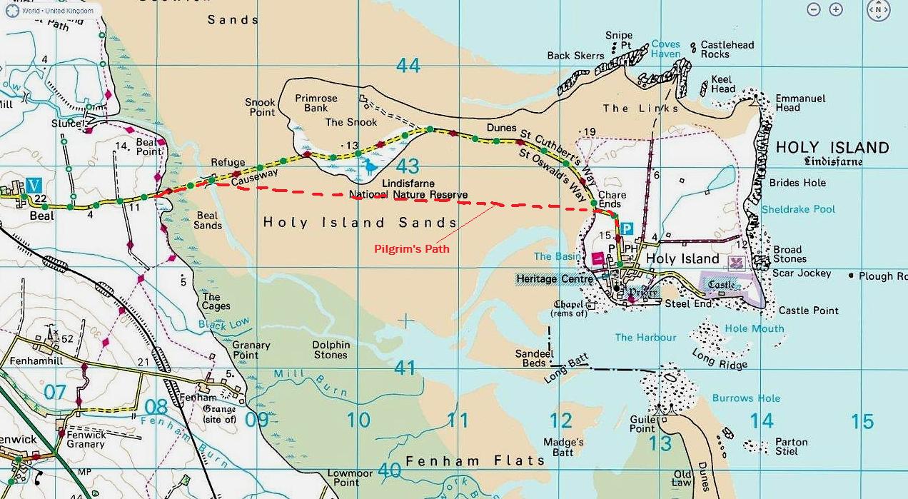
- Map showing Chare Ends, the modern road and the Pilgrim's Path, via Because They're There
- Remains of the jetties, limekilns and eastern tramway near Castle Point, via Britain From Above (free login needed to zoom)
- Summary (on page 12), via Narrow Gauge News
- The island's limeburning past, via The National Trust
- Kennedy Limeworks and Tripping Chare Jetty, via Keys to the Past
Einzelnachweise
Koordinaten: 55° 40′ 53,5″ N, 1° 47′ 2,1″ W